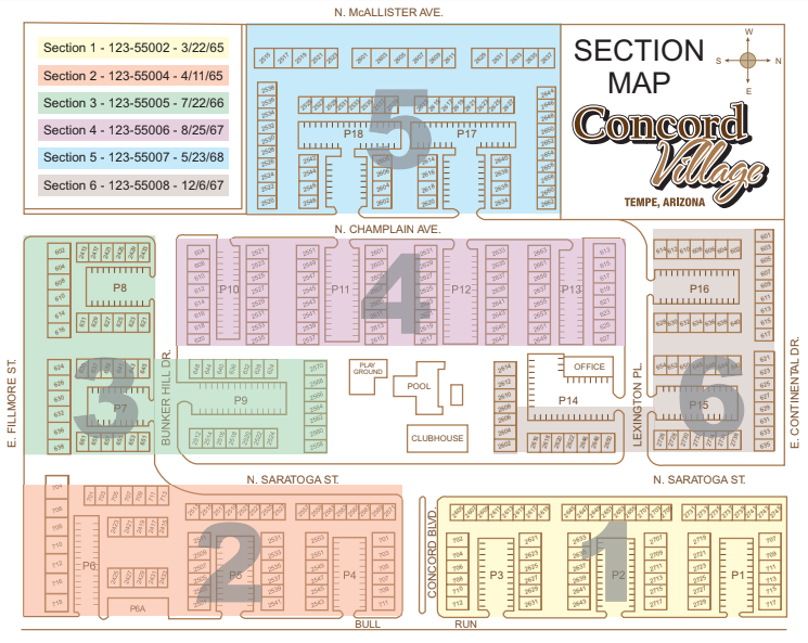
Below are some maps of the Village, either public or shared liberally with the members for use in resident-related planning and discussion. Click on any of the images below to see either the detailed PDF file or the high resolution image or PDF.
|
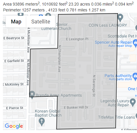
click on this link for a live google interactive satellite map |
|
click here to download a pdf of the section map
|
|
Above is a screengrab from www.mapdevelopers.com which calculates the property size
|
|
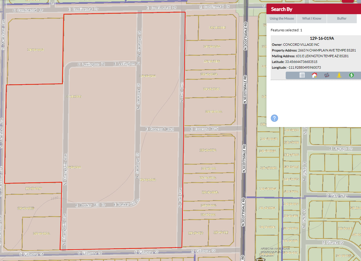
The official source, however, is the city assessor's office indicates the property |


